
Trail Notes | January 2020

I think this year might be the year of me trying out lots of new things on this blog, Instagram and YouTube and, I guess, just seeing what works and what you guys like! Something I’ve been thinking about, is how I can show you a little big about each of the walks I’ve done each month, so I’m starting a new monthly Trail Notes series in which I can share photos and notes from the trail. This, essentially, will be little snippets and photos from walks, to inspire you to get outside or try them out for yourself.
So, I’m kicking off this new series in a New Year. This past month, I’ve stayed local in the Peak District and have been enjoying new walks close to home, walks with friends, alone, with the dogs and with Harvey. I’ve redone some walks I’ve done before, and also tried some new ones. I would say that this month really has reignited my love for a simple ramble in the hills. None of the walks I have done have been exceptionally long or adventurous, but they have been beautiful, refreshing and calm. I feel lucky to have so many beautiful places to walk right on my doorstep.
Alport Castles, Derwent Reservoir & Back Tor — 12 miles
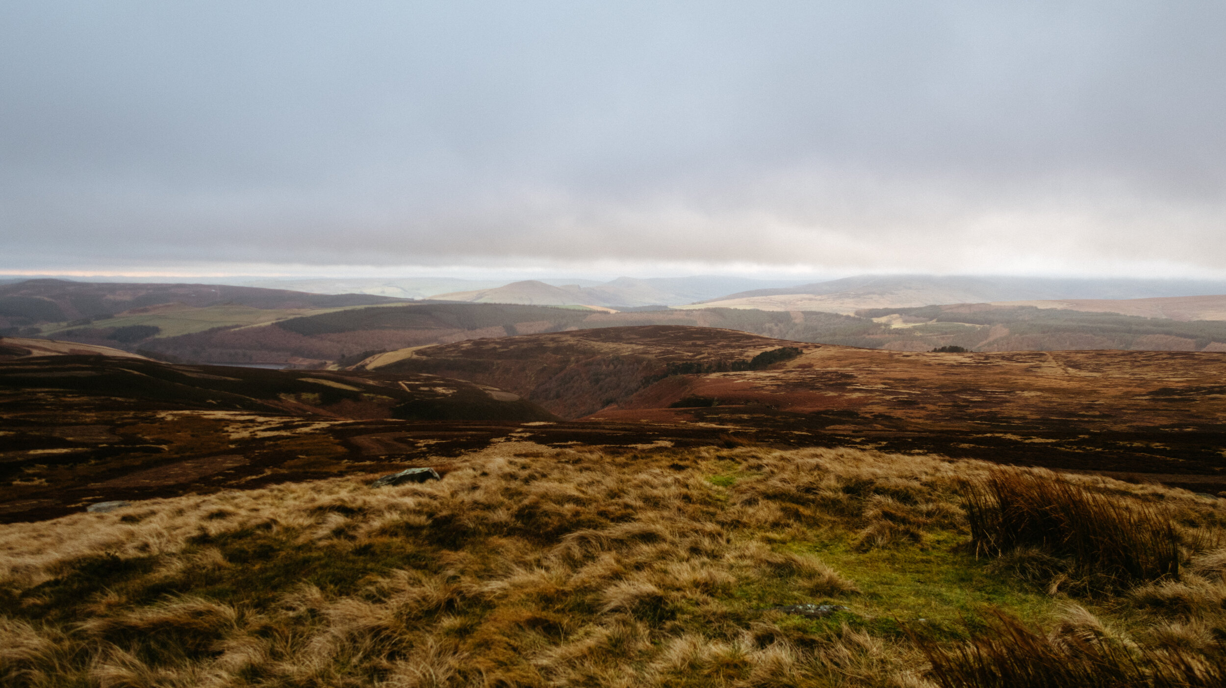
I’m starting off with the longest walk I did this month. I planned a route that went from the A57 Snake Pass, over Alport Castles, down to Derwent Reservoir and then back up ascending to Lost Lad End and Back Tor. This is the point where I thought I would camp. I didn’t… For a number of reasons that I outlined in the video (below). So, I descended down to Strines Road and headed to the pub instead. Altogether it was a 12 mile hike with a backpack full of camping gear — I can’t deny, I was utterly exhausted when I stumbled into the Strines Inn. Cold to my core with a sore knee, shoulders and legs. Despite that, I felt proud for having done such a long hike with my camping gear on my back. Though I chose not to wildcamp, I looked at the walk as training for future adventures — lessons learned, navigation practised, body conditioned.
I have mixed thoughts on the walk itself. It was pretty difficult to find the start of the trail from where I parked on the A57. I had to walk along the road a little, and then through a farmyard with some angry dogs yapping at me to leave. I did… as quickly as I could! Then, I was on the right track which always makes me very happy to know. I could see Alport Castles already to my right, shrouded in a blanket of mist and fog, yet looking invitingly eery nonetheless. When I got onto the moor above Alport Castles, I became a little nervous by how foggy it was and how I would manage to navigate over the moor. It turns out that the footpath was very well-defined, and the clouds cleared as I started descending down to the reservoir. This part of the walk was my least favourite. A long stretch of road with quite a lot of people that ran along the reservoir’s edge. Of course, it was beautiful, but I sometimes find low-level walking boring, especially on tarmac, and I couldn’t wait to get back up into the hills.
When I crossed the reservoir (at last!), I was so eager to get back into the hills that I took a turning I couldn’t see on the map and got a little lost. I rambled my way up sheep tracks and across steep heather-strewn moors until, finally, I relievedly found a wide track. From here, as I left reservoir views behind, the sun started dipping and I was feeling pretty exhausted. I made the final ascent up to Lost Lad End and Back Tor, where the wind howled and rain drizzled. Tired and cold to my core, I made the decision not to camp and hobbled down to the pub for a cup of tea and an open fire.
I can’t deny, this hike was a bit of an epic adventure! It was brilliant to feel I was practising my navigation, and I always feel I learn so much when I spend time in the hills solo. Despite not camping, I don’t regret embarking on this walk at all and hope to redo part of it in the future (but make it a little longer and cut off the boring road section by heading north straight onto the moor).


The Roaches & Lud’s Church - 7 miles
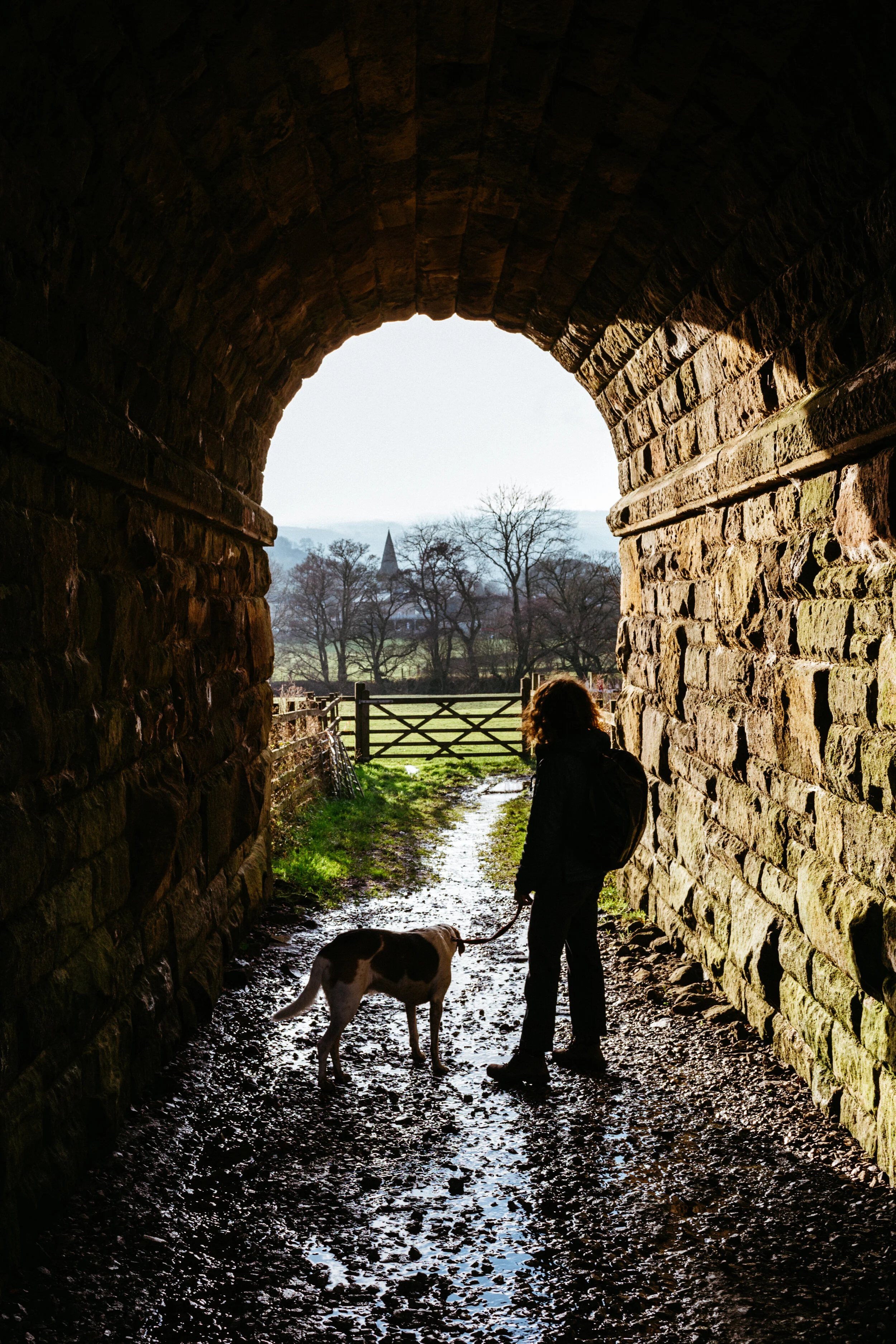
Harvey and I decided to head down to the White Peak on Oslo’s 6th Birthday to go for a walk along the Roaches & into Lud’s Church. We parked on Roaches Road just beneath the Roaches itself and walked all the way along the ridge in the howling wind and rain, eventually dropping back down to the road where we descended into the woods. The woodland provided a bit of shelter from the tumultuous weather, and a brief lunchtime respite for homemade soup and croutons inside Lud’s Church. We then headed back up onto the moor before walking back along the Roaches, where yet again the wind howled and the rain poured down on us. For a brief moment just before we descended, the sun appeared out of the mist, casting beautiful light and shadows onto the surrounding hills. It was proof enough that getting out and walking, even on the bad-weather days, is always worth it.


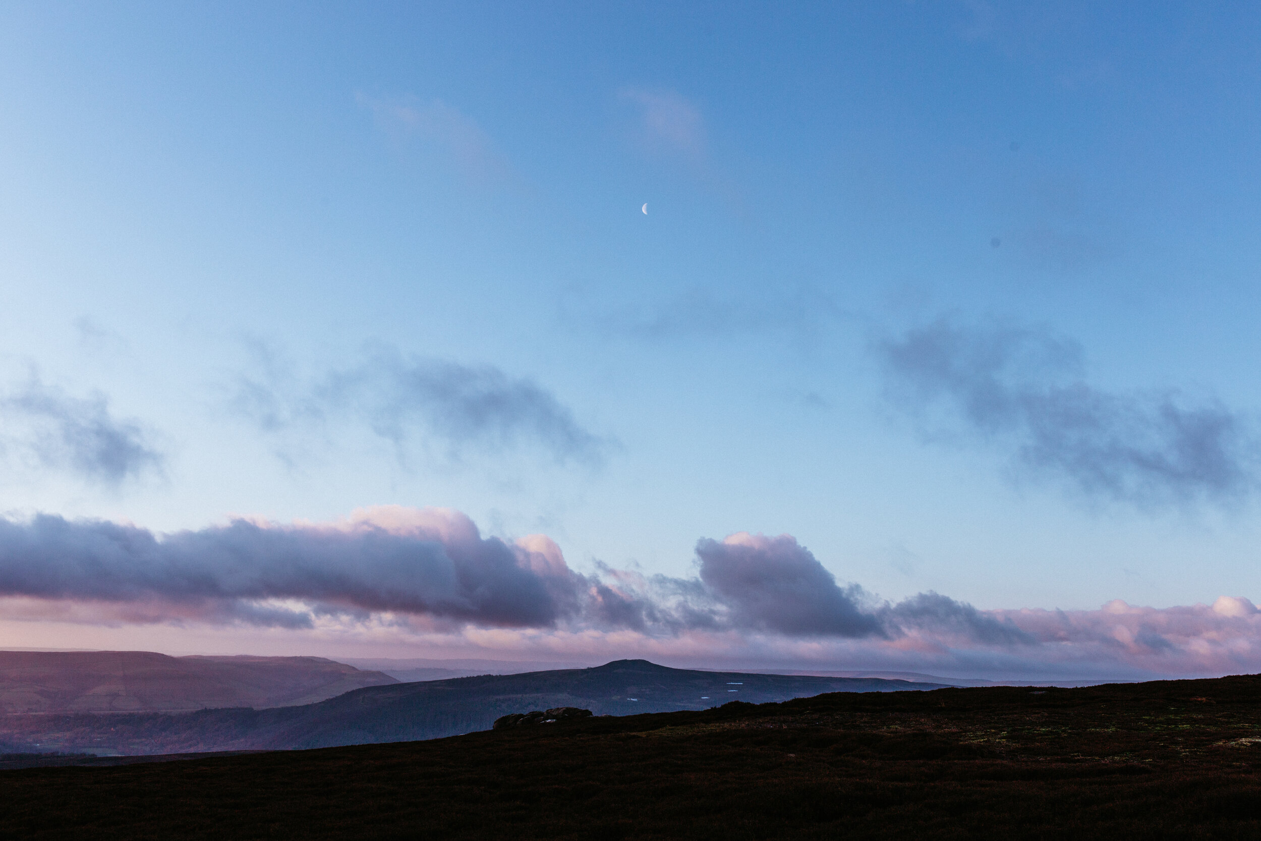
Derwent Edge - 4 miles
So this one wasn’t so much of a big hike, but more of a ramble up the hill for sunrise and breakfast — also carrying two heavy bouldering pads for a quick morning boulder! It was a Saturday morning, and as Harvey was getting up early to head to work anyway, I decided to get up at the same time and go and get some photos of the morning glow at possibly my favourite place in the Peak District, Derwent Edge. I ascended from a layby on Mortimer Road but didn’t quite make it right onto the Edge for sunrise. As it turns out, the sun actually rises over Bamford Edge, so I stopped just off the path to capture the rich red glow in the sky, as low clouds hung suspended over the Edge. Later, the clouds cleared giving way to beautiful blue skies looking down to Ladybower.
Despite the cloudless sky and warming sun, it was absolutely freezing and I dreaded having to take off my big down jacket, fleecy gloves and cosy socks to boulder. After some warming tea and a honey sandwich, I braved the cold and did a quick hour of clambering up gritstone before my fingers went numb and I headed back to my car. Getting up for sunrise is one of my favourite things to do, and I was so pleased with the photos when I edited them later.


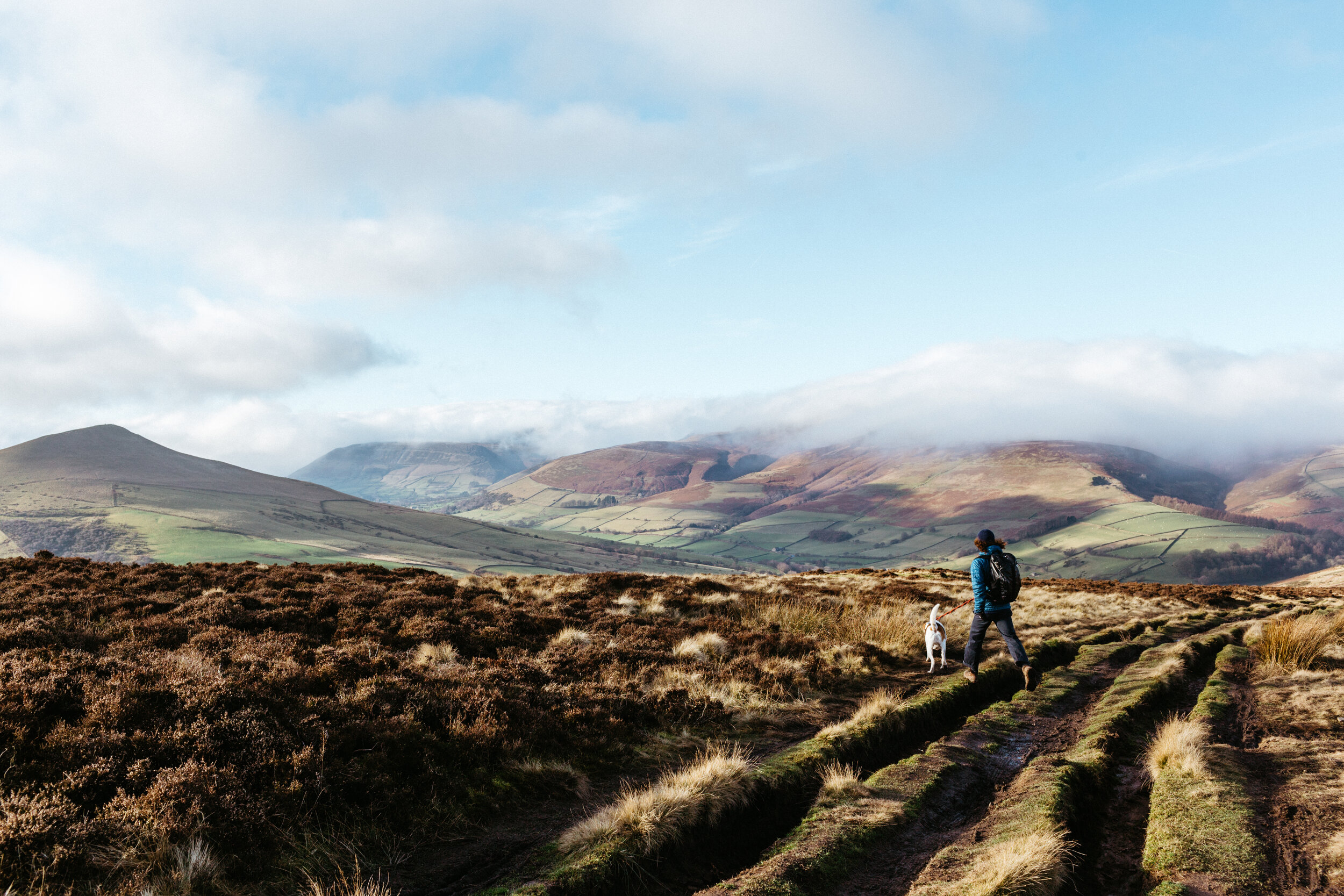
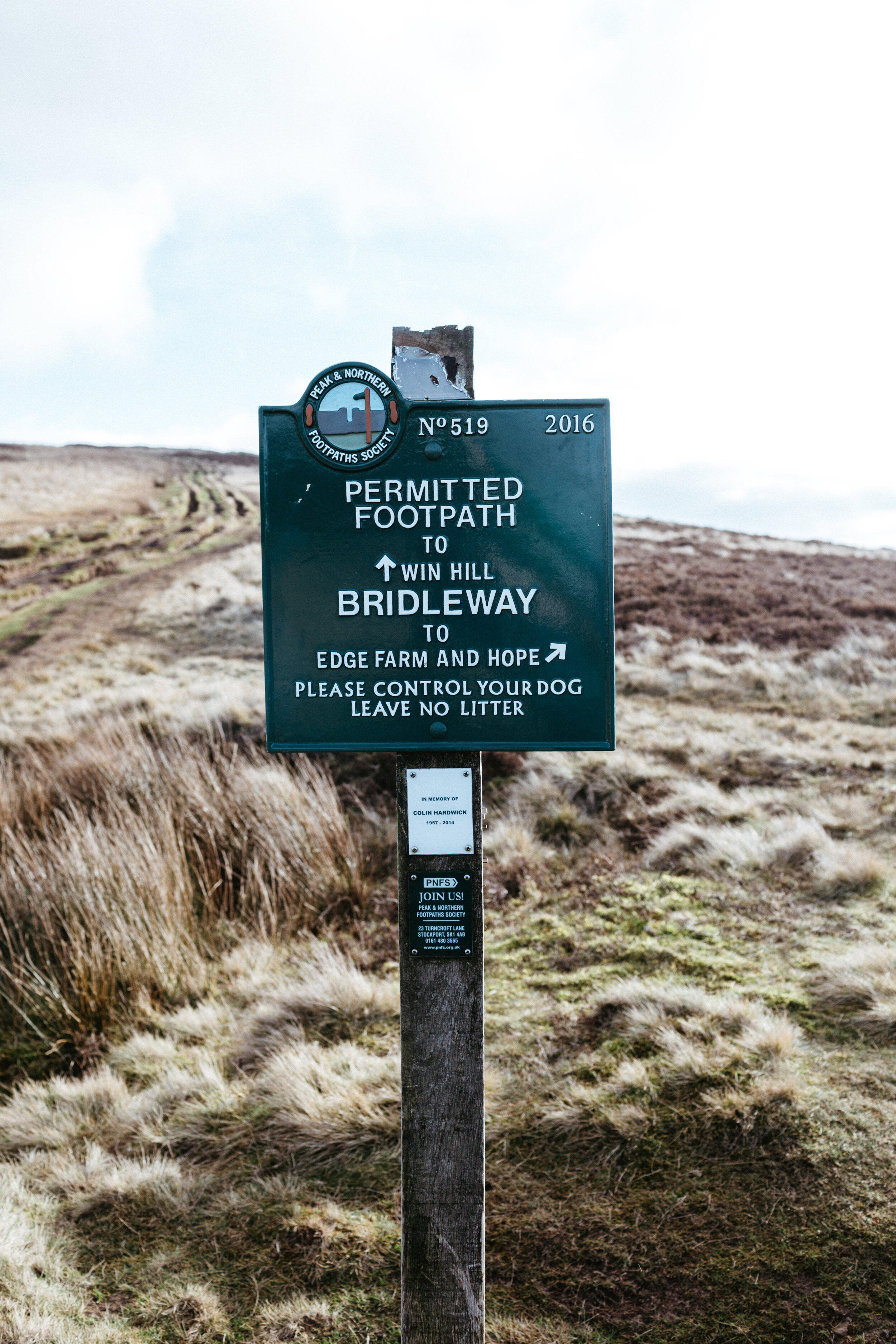
Win Hill from Hope - 4 miles
I met up with my good friend Ethan for a walk in the Peak District on a week when I had both Oslo and Ola to take care of. I’d been really wanting to try the walk from Hope up to Win Hill, as I’ve previously only done the walk from the Yorkshire Bridge Inn. It was a little difficult navigating our way out of Hope, and I think we ended up on a different path than I had planned to ascend up to the peak. But nevertheless, the views were marvellous looking down to the stunning Hope Valley. We ate homemade cauliflower soup with croutons for lunch before taking the return route I had planned.
This was my favourite part of the walk, as we followed the moor for a while before descending towards the woods surrounding Ladybower Reservoir, where views across to Kinder Scout with a blanket of cloud were just beautiful! We then took a path that switched back and descended to Hope the same way we came. We headed to the Grasshopper Cafe for coffee and cake, to end a wonderful walk in the Peak District.
I’m still perfecting this route, therefore there is no route map to go with it yet!


Mam Tor from Edale - 5 miles
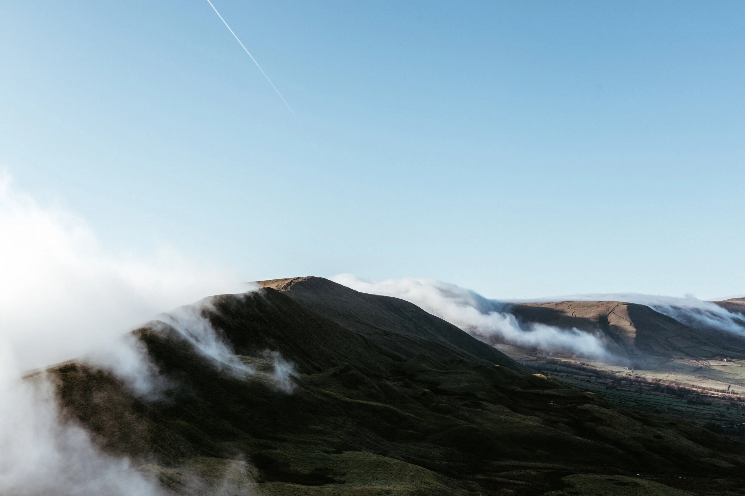
This was a day I knew would be difficult. It should have been my brother’s 24th Birthday, so we took his dogs, Oslo and Ola, up to Mam Tor — a place I have visited at sunrise with Macky and that we loved together. There was something very special and almost magic about the day. Though it was late January, I walked up the hill in a t-shirt and was met by a sea of cloud over the valley floor. We ate soup and snacks, before descending into the mist and watching cloud dance around the Great Ridgeline. It was like nothing I have seen before; a gift from my brother on what he knew would be a difficult day.
In terms of the walk itself, we set off from Edale and headed up to Hollins Cross before ascending the final stretch to the summit. I’ve actually previously written up the full walking route, which you can see here. I find it a lovely and not too taxing ramble onto one of the most popular but beautiful areas of the Peak District.

White Edge, Froggatt Edge & Curbar Edge — 6 miles
I woke up feeling stressed after a busy weekend, headed straight to work with Oslo in tow and couldn’t shake off that anxious feeling in the pit of my stomach all morning. And so, leaving work at 2pm when I eventually gave in to Oslo’s puppy dog eyes, I decided to take Oslo (and myself) for a good, long walk to get us both feeling a little more ourselves. It was exactly what we needed…
We parked at Curbar Gap and headed up onto White Edge. We followed this edge all the way along until we saw a signpost for The Grouse Inn, taking this footpath all the way down to the pub. From here, you have to follow the road a little ways until you meet another footpath that takes you into the woods above Froggatt Edge. We followed this edge until meeting Curbar Edge, just as the sun started setting and the sky lit up with some beautiful soft pink and purple tones. It was a good 6-mile stomp and I instantly felt myself again after having some fresh air in my lungs.


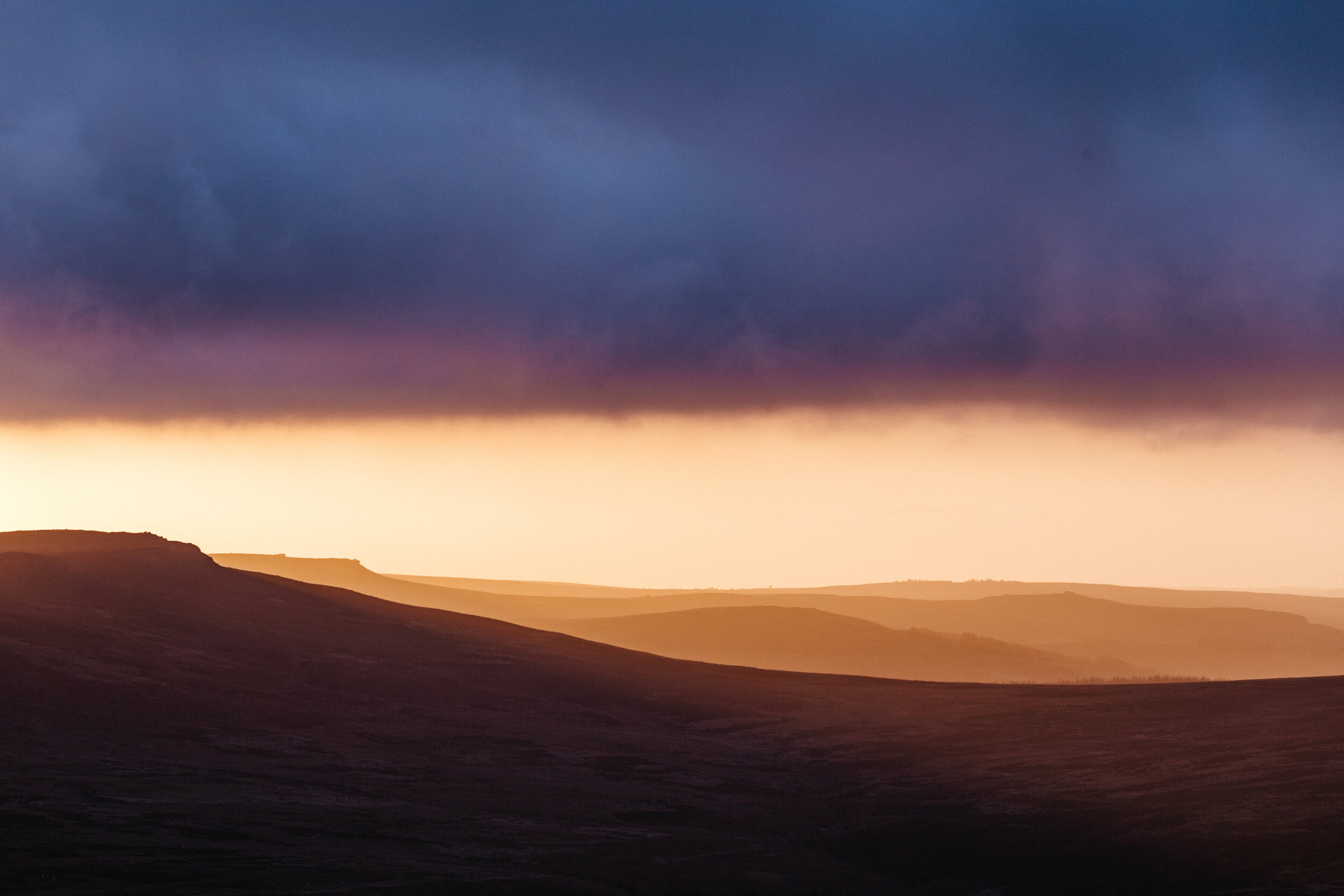
Back Tor - 3.5 miles
With the weather forecasting snow in the Peak District, I couldn’t resist getting up at sunrise for a ramble up Derwent Edge. It’s only around 15 minutes from our house to the start of a trail that leads onto the Edge, and as promised the snow was falling right from when we left the house. It was incredibly windy and cold, and I was glad to be wrapped up in a down jacket and my mountaineering coat, along with waterproof trousers, gloves and a hat. Oslo also had his little coat on but looked to be having the absolute best time sniffing around in the snow, despite the cold. The sun rise was just gorgeous, with snow covering all of the surrounding peaks in the distance and casting a pink glow onto the snowy hills. I really hope we get a longer period of snow in the Peak District soon as I can’t wait to do some more snowy walks in the snow and maybe some wildcamping too!


Thanks for reading! I hope some of these walks inspire you to get outside and explore your own local area, or to head to the Peak District to try them out for yourself! Next month, I’m going to Spain for a week with work and am also planning a couple of trips up to the Lakes, so there may be a few more exotic places than the usual Peak District rambles!
See you soon.
Athena x